
URBAN DEVELOPMENT PREPROJECT of EL CARPINTERO SLUM
CARACAS, VENEZUELA. 2002.
The physical improvement and consolidation of slums aims to incorporate them into the general urban structure. The analysis for this project covered all of the strategic points that would guarantee such incorporation, while also providing a reference for the respective urban design operations. The idea is to provide coherence to these operations: they should objectively and for a set time combine economic and social efforts and the complex morphology implied by strategies of unity and articulation, with recognizable rules and exceptions.
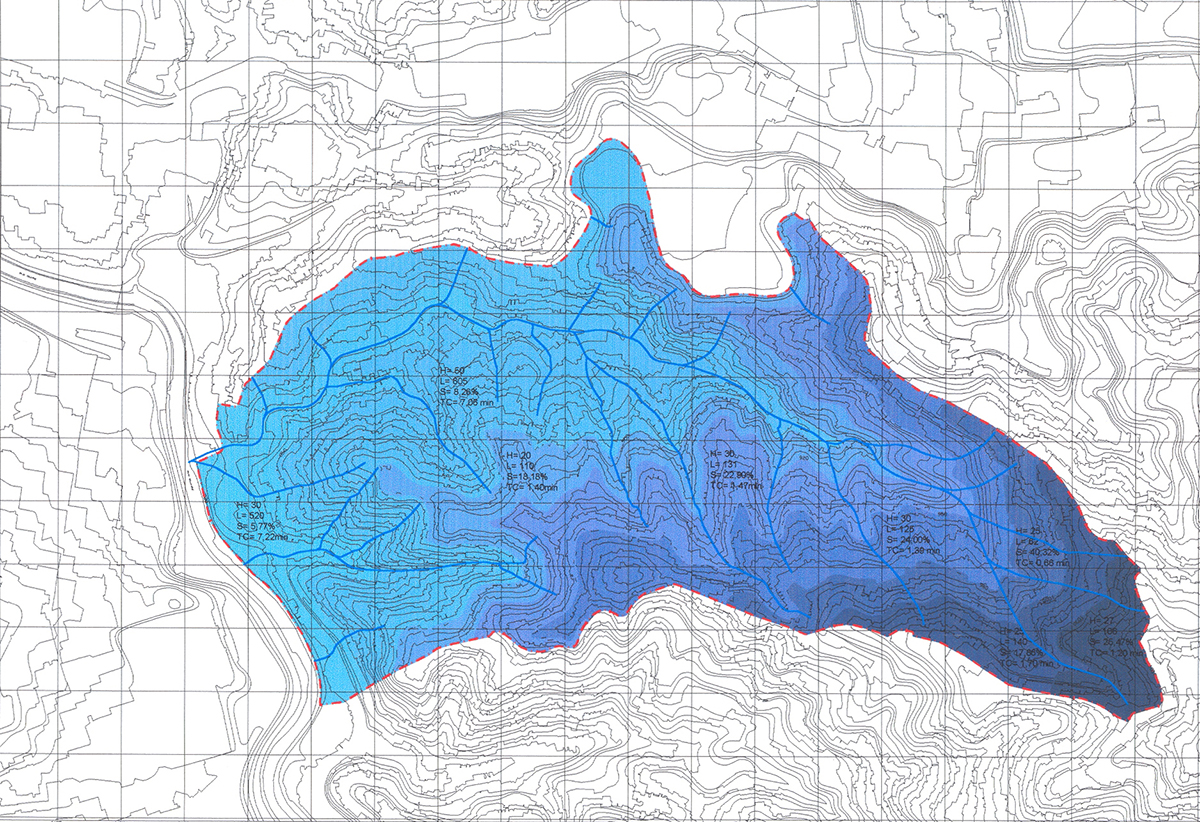
As instruments for implementing this project, the Special Plans for the Urban Ordering of Physical Improvement Programs cover the physical planning variables for an entire urban zone (consisting principally of slums) at a level of detail that allows adjusting the Urban Design Units for that part of the city. They also establish guidelines and larger projects for facilities, replacement housing, roads, risk prevention (geological and flooding), and infrastructure, according to population and soil usage projections and provisions, among other urban structure variables for the area as a whole.
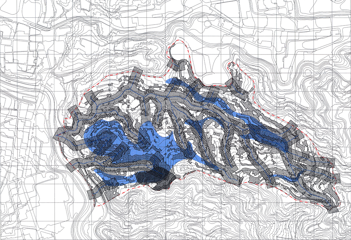
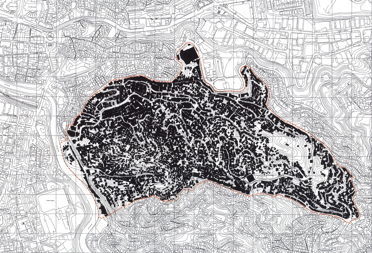
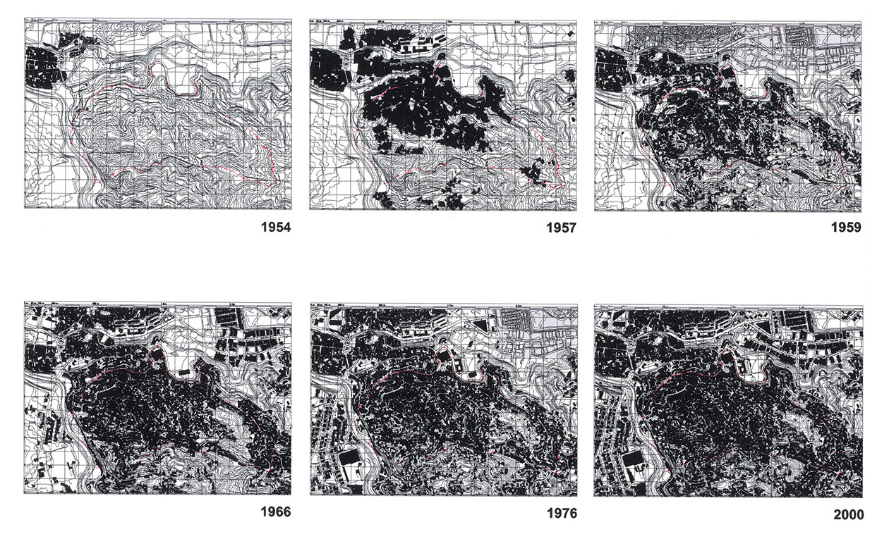
The Carpintero Urban Design Unit (UDU-8.2) is located east of the Caracas Internal Metropolitan Area. It is administratively located in the Sucre Municipality of Miranda State, constituting an integral part of the Capital District. This is an uncontrolled urban development area with problems caused primarily by the insufficiency of facilities, roads, transportation, and housing to satisfy the growing needs of the population settled there. It maintains a close functional tie with the El Llanito and Palo Verde zones and to a lesser degree with Petare, which are major centers for employment, commerce and services for UDU-8.2.
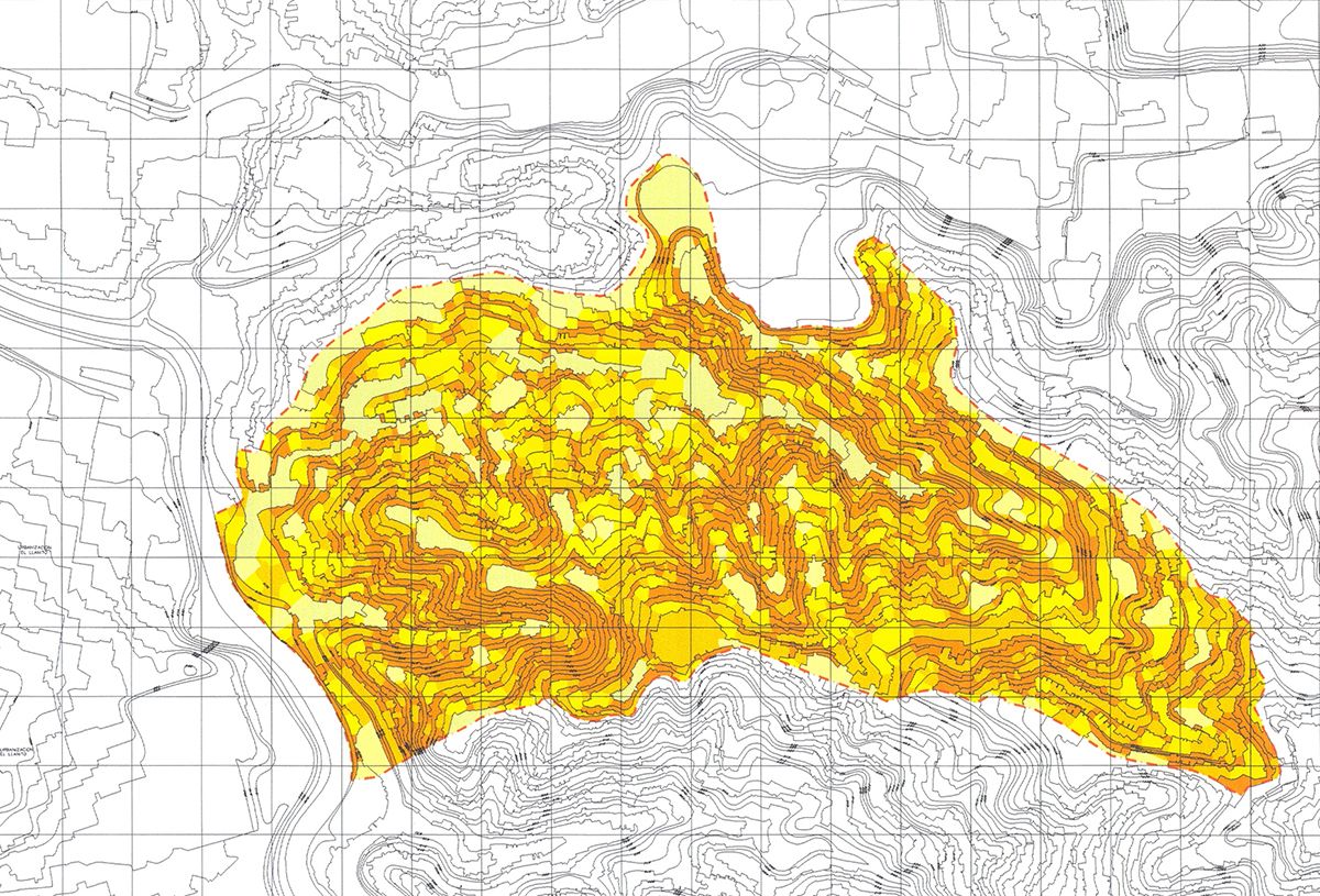
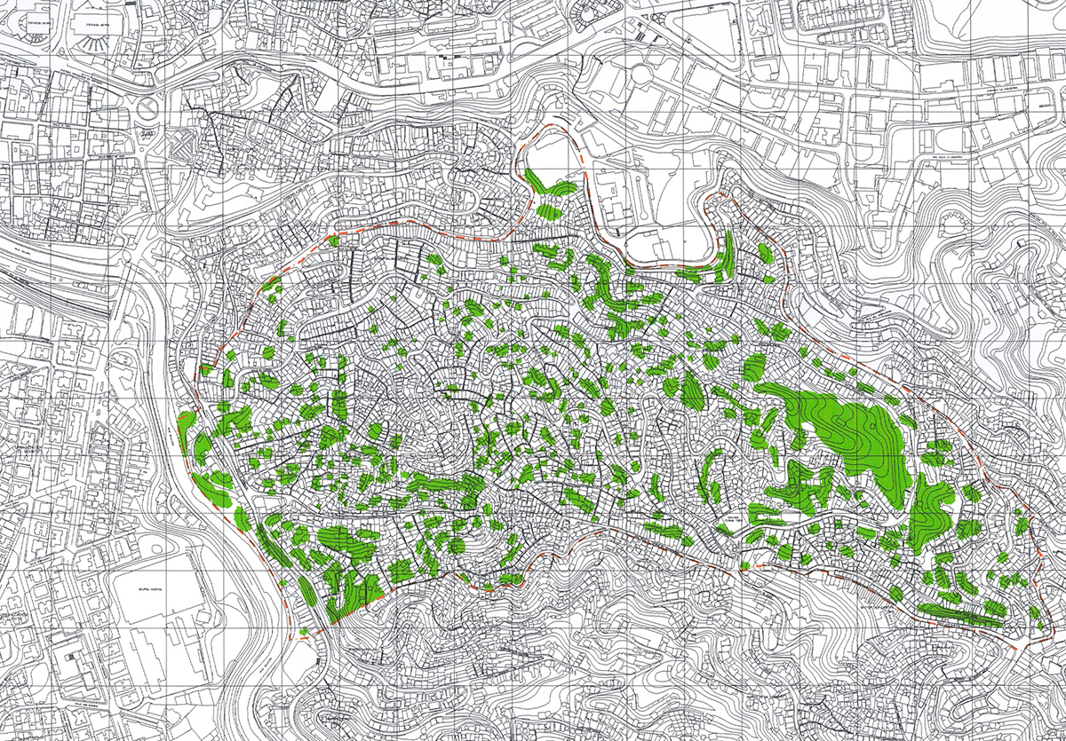
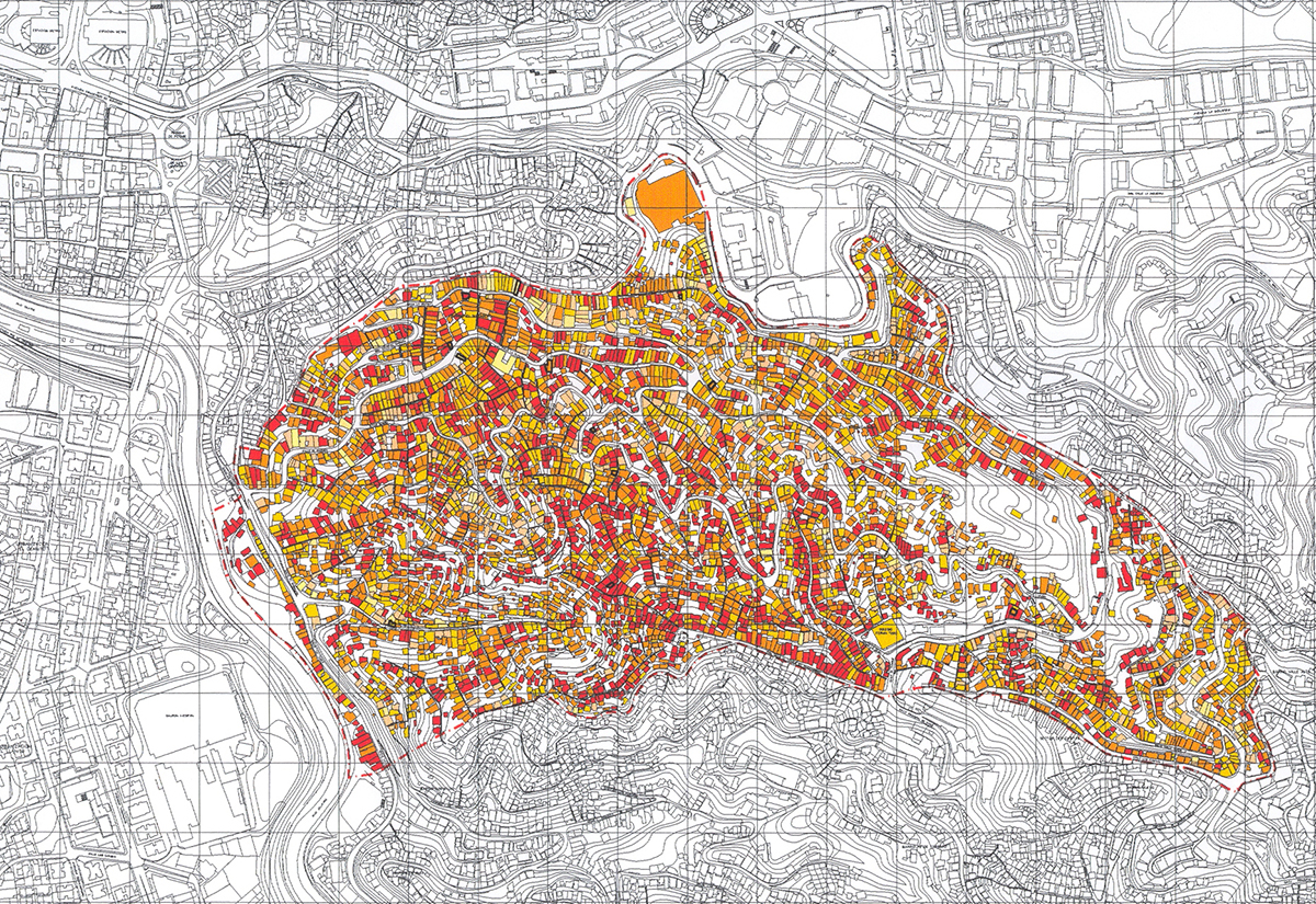
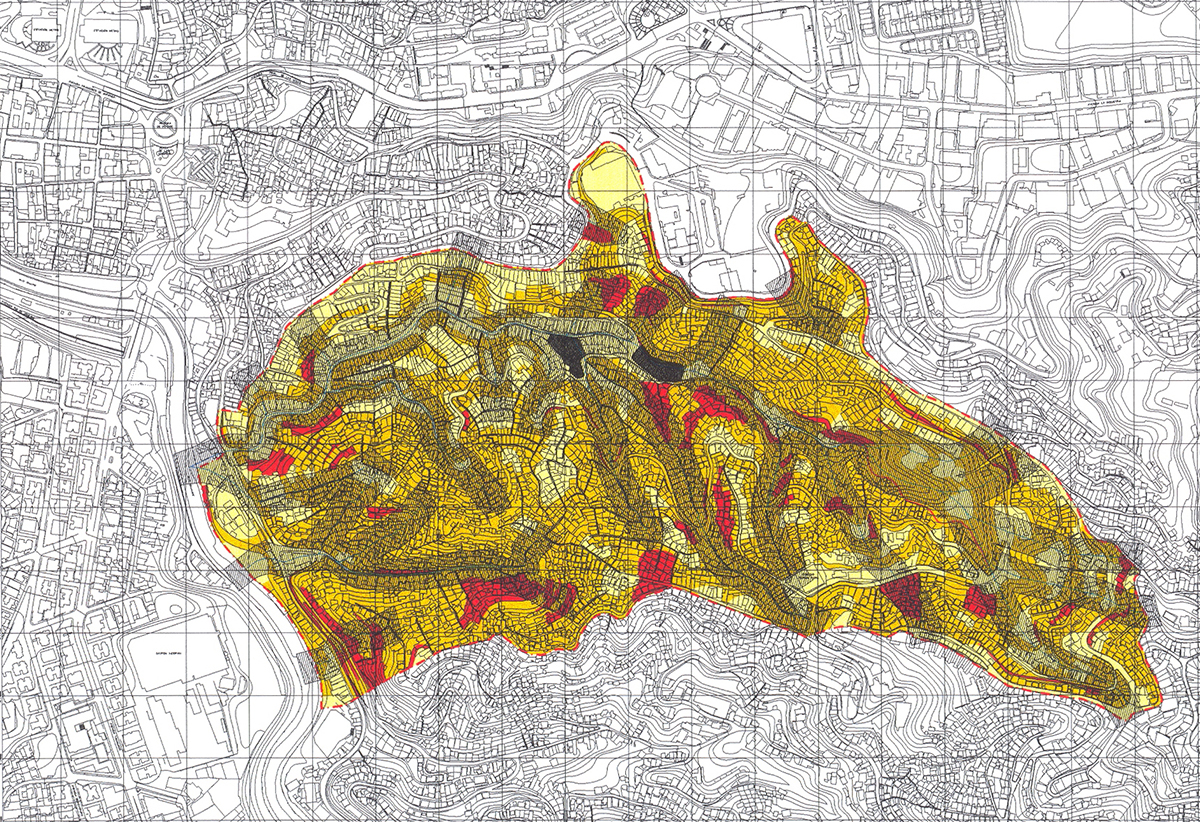
Almost the entire surface of UDU-8.2 El Carpintero is occupied: small vacant areas with vegetation are observed on land where the predominant slopes are greater than 60%. Nonetheless, some available lots not under litigation are potentially available to develop substitute housing projects and social facilities.
The proposals contained in these programs are oriented towards three primary lines of action:
Resolve the space requirements for urban facilities.
Propose routes for internal traffic flow.
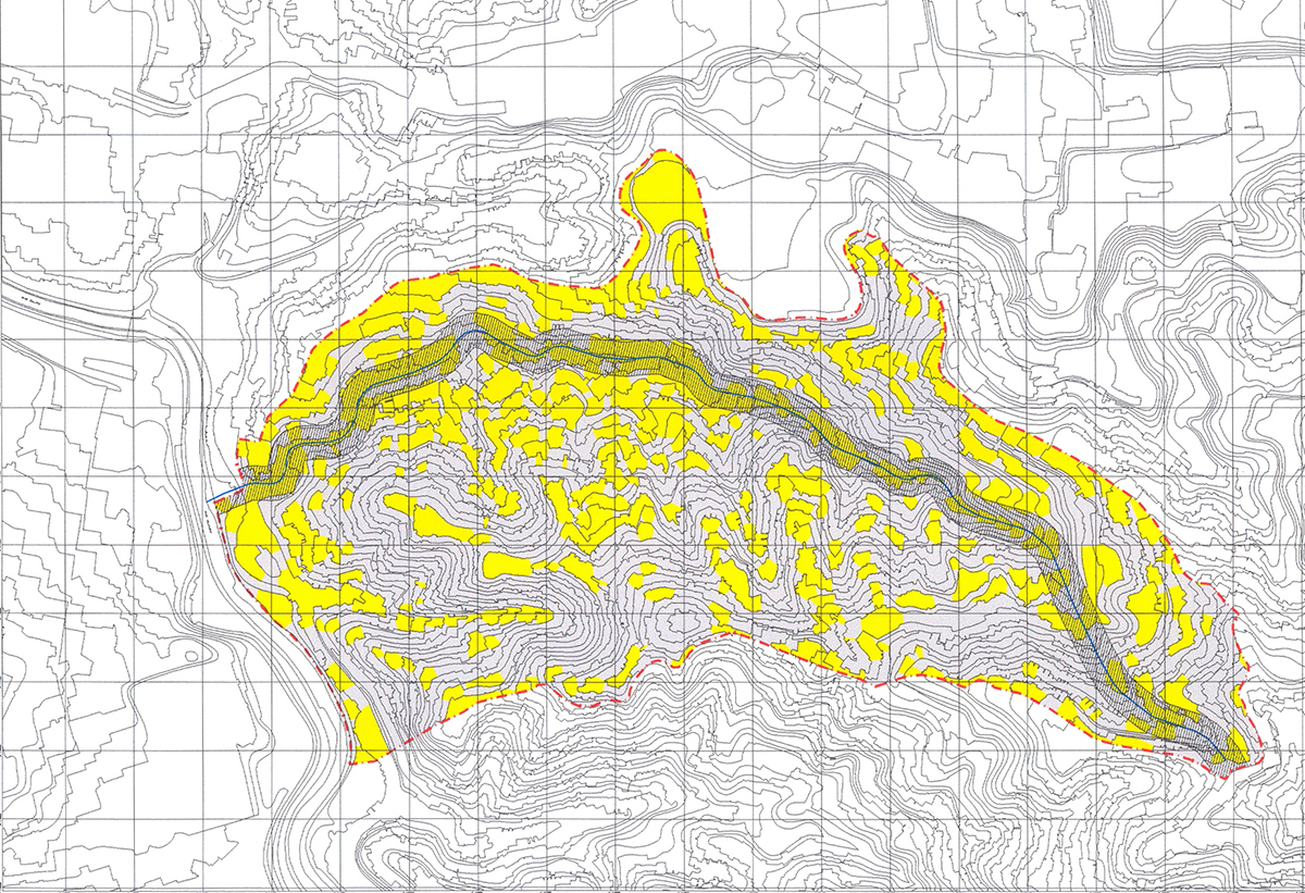
Propose solutions for the location and design of replacements for those structures that are affected due to facilities, routes, and geological risk, according to the socio-economic reality of the neighborhood.
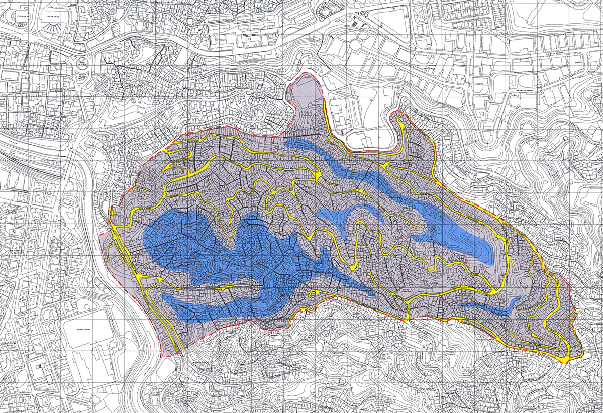
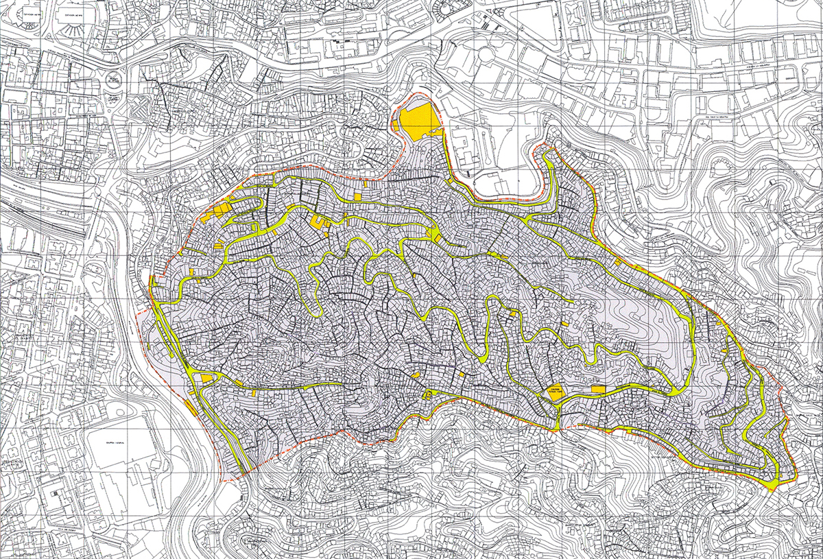
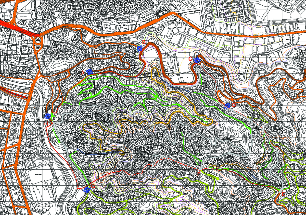
A sustained process of urban transformation is proposed. Starting with the concentration of existing and proposed community facilities, the community’s primary services and local commercial activity would be located in four nuclei or urban centers, accompanied by major roads and routes for public transportation to facilitate the development of activities typical of a downtown.
Given the site’s difficult topography, the road structure consists of a very simple traffic system, with minimum intersections and a complementary pedestrian route to facilitate access to the most precarious sectors in terms of transportation and basic infrastructure services.
Architecture:
Arch. Ana Lasala
Arch. Isabel Lasala
Collaborators:
Arch. María José García
Arch. Jennifer Pérez
Urban Planning:
Urb. Izaskun Landa
Urb. Alicia Carril
Project Management:
Arch. Eleazar Parra
Eng. Luciano Basianni
Arch. Yudmar Reyes
Structure:
Erasmo Galavis
José Galiño
Hydraulics:
Eng. Pedro Alam
Geology and Geotechnical Engineering::
Eng. Alfredo D’Otavi
Roads:
Eng. Oscar Anzola
Electrical Installations:
Eng. Sixto Alarcón
Landscaping:
Arch. Beatrice Camisuli
Arch. José Blondet